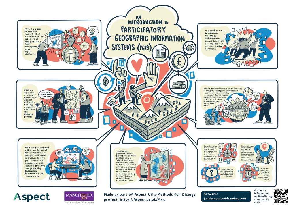
Participatory GIS (PGIS) is a broad term that refers to a collection of methods intended to collect map-based data from participants using digital platforms. Though there is no universally accepted definition, the term can be applied to any approach that seeks to collect map data from participants using a digital map.
PGIS approaches were created as a way of empowering citizens by incorporating non-expert knowledge into decision making (e.g., for collecting community opinion relating to a planning application) and enhancing democracy within communities. Over time, the methods have broadened in their scope, including their use in advocacy and seeking to provide a voice to marginalised groups.
At a practical level, Participatory GIS can be situated in the broader field of Participatory Mapping, which comprises:
- Participatory GIS (also Public Participatory GIS, PPGIS), in which participants add data onto a digital map interface (e.g., a Google Map), normally via a website (though sometimes using desktop GIS software.
- Sketch Mapping, in which participants use pens to draw data onto a paper base map.
- Mental Mapping, in which participants draw a map on top of a blank sheet of paper.
All these approaches share the same goals (and some approaches can cross or sit between two categories), but they each have their own strengths and weaknesses. It is therefore useful to consider the full range to find the approach that best fits your project. This how-to guide will provide a step-by-step guide to a PGIS platform called Map-Me, which is a good example of a general-purpose and easy to use approach to engaging with PGIS.


